

Regional Setting
Inside a Producing Camp
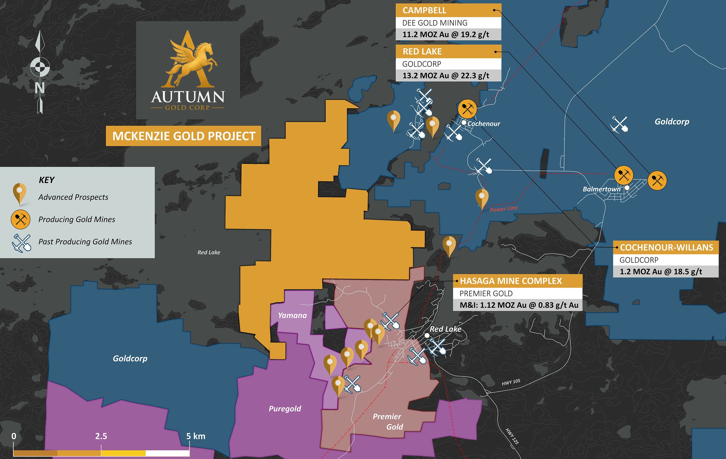
1,398 hectares in a single block on the western and northern flank of the Red Lake Gold Camp, near producing mines and past producers.
In the Heart of Red Lake
1,398 hectares in a single block along the southern part of Red Lake, near producing mines and past producers.
Access and Neighbours
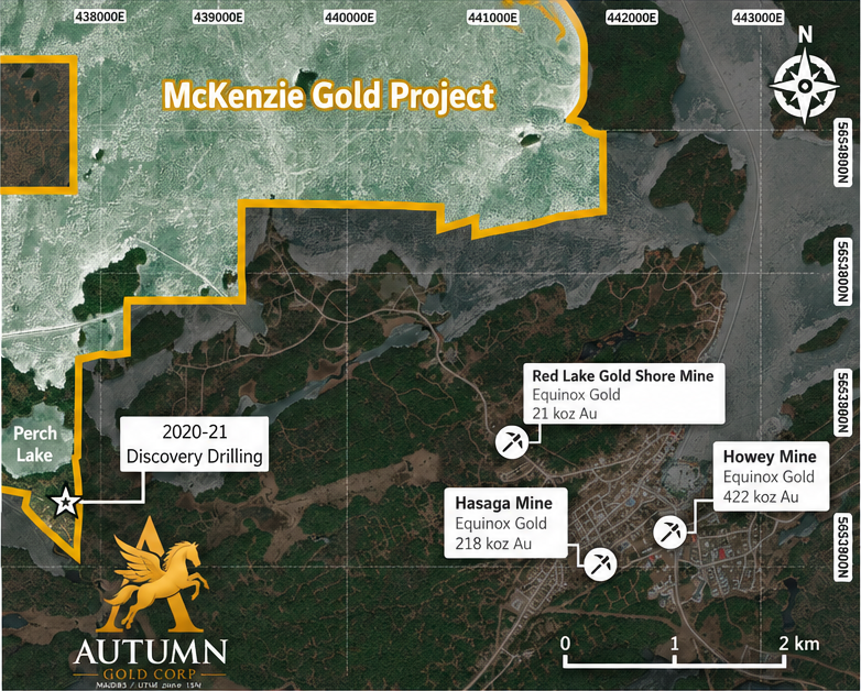
~4 km west of Hasaga, near ground held by Evolution, Equinox and West Red Lake Gold. Paved roads and an existing power line serve the district.
District Operators
The Red Lake Gold Camp
ASX: EVN
Evolution Mining
Red Lake, Campbell, Cochenour-Willans
TSX: EQX
Equinox Gold
Hasaga, Howey, Gold Shore
TSXV: WRLG
West Red Lake Gold
Madsen, Starratt-Olsen
Proposed CSE: AUTM
Autumn Gold Corp.
Pre-listing
McKenzie Gold Project · 1,398 ha
References to neighbouring properties are for district context only. Mineralization on nearby properties is not necessarily indicative of mineralization at McKenzie.
Red Lake 100m+ Gold Intercepts
Rare and World Class
| Rank | Year | Project | Hole | Length (m) | Grade (g/t Au) | Company |
|---|---|---|---|---|---|---|
| 1 | 2020 | Great Bear / Dixie | BR-118 | 104.15 | 2.67 | Great Bear Resources |
| 2 | 2015 | Hasaga | HLD004 | 122.5 | 1.61 | Premier Gold |
| 3 | 2021 | McKenzie | MK-21-019 | 136.5 | 1.25 | Autumn Gold Corp. |
| 4 | 2017 | Hasaga | HMP161 | 181.0 | 1.21 | Premier Gold |
| 5 | 2015 | Hasaga | HMP024 | 107.0 | 1.19 | Premier Gold |
| 6 | 2016 | Hasaga | HMP106 | 117.0 | 1.18 | Premier Gold |
| 7 | 2016 | Hasaga | HLD052 | 177.0 | 1.09 | Premier Gold |
| 8 | 2021 | Great Bear / Dixie | BR-306 | 106.7 | 1.08 | Great Bear Resources |
| 9 | 2016 | Hasaga | HLD060 | 193.0 | 1.04 | Premier Gold |
Only nine identified in ~40 years of reported drilling. Seven of the nine occur at McKenzie and nearby Hasaga.
- 9
- Only 9 qualifying intercepts identifiedin our review of approximately 40 years of reported Red Lake drilling.
- 2015–21
- All 9 occurred between 2015 and 2021.
- 7 of 9
- Seven of the nine occur at McKenzie and nearby Hasaga.
- #3
- McKenzie ranks #3 by average gradeamong the identified 100m+ intercepts (136.5 m @ 1.25 g/t Au).
Source: Review of publicly available historical and modern drill results in the Red Lake Gold District. Reported intervals are generally core/downhole lengths and may not represent true widths. The review is not an exhaustive audit of every historical drill assay in the district. Third-party results have not been verified by the Company's QP. Mineralization on nearby properties is not necessarily indicative of mineralization at McKenzie.
District Context
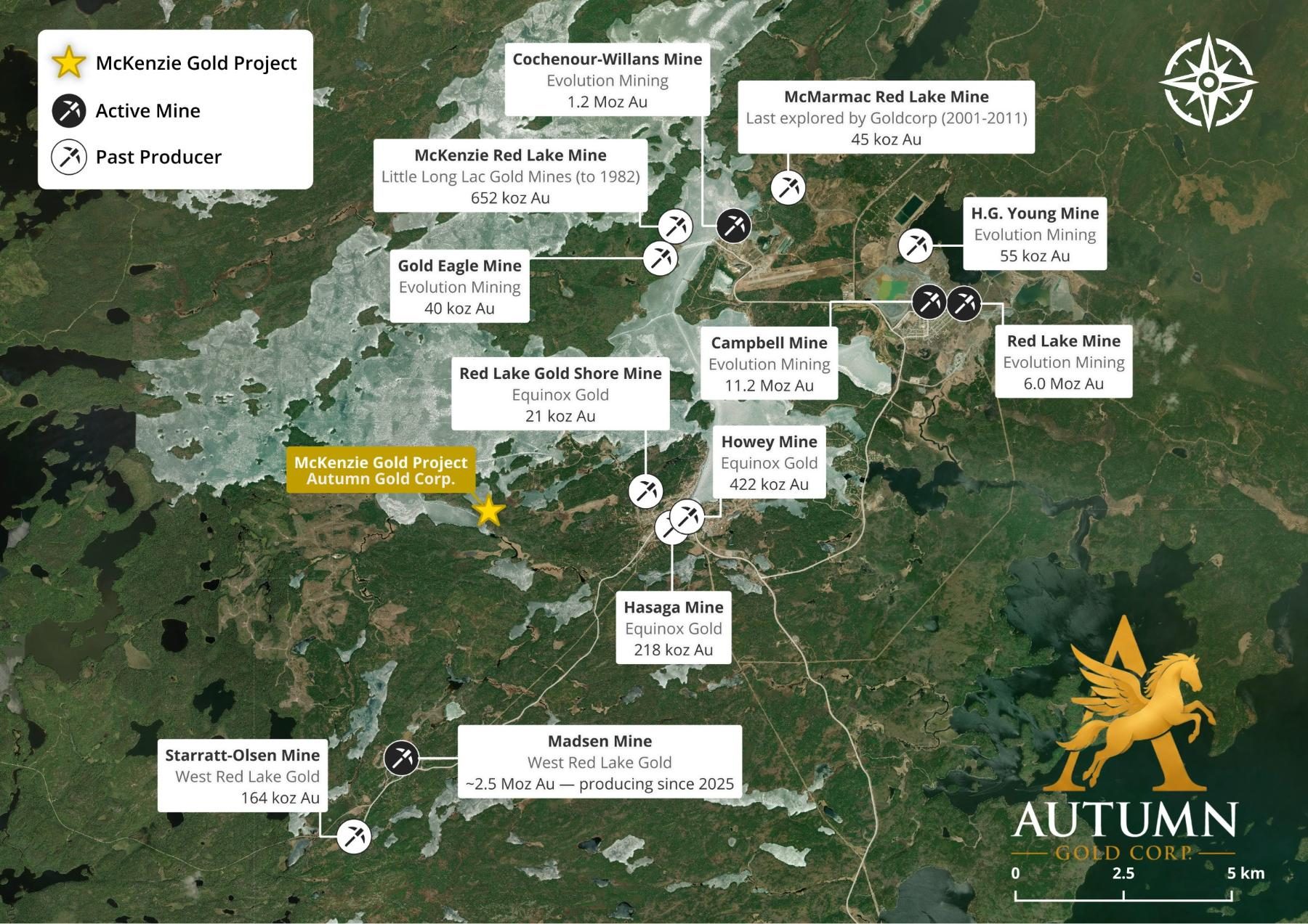
Mines of the Red Lake Camp
| Mine Name | Operator | Production |
|---|---|---|
| McKenzie Gold Project | Autumn Gold Corp. | — |
| Cochenour-Willans Mine | Evolution Mining | 1.2 Moz Au |
| McMarmac Red Lake Mine | — | Last explored by Goldcorp (2001-2011) 45 koz Au |
| McKenzie Red Lake Mine | Little Long Lac Gold Mines | (to 1982) 652 koz Au |
| H.G. Young Mine | Evolution Mining | 55 koz Au |
| Gold Eagle Mine | Evolution Mining | 40 koz Au |
| Campbell Mine | Evolution Mining | 11.2 Moz Au |
| Red Lake Mine | Evolution Mining | 6.0 Moz Au |
| Red Lake Gold Shore Mine | Equinox Gold | 21 koz Au |
| Howey Mine | Equinox Gold | 422 koz Au |
| Hasaga Mine | Equinox Gold | 218 koz Au |
| Starratt-Olsen Mine | West Red Lake Gold | 164 koz Au |
| Madsen Mine | West Red Lake Gold | ~2.5 Moz Au — producing since 2025 |
References to neighbouring and regional deposits and past-producing mines — including Red Lake, Campbell, Cochenour-Willans and the Hasaga Property — are for geological and district context only. Those figures are as reported by their respective operators and have not been independently verified by the Company. Mineralization hosted on adjacent or nearby properties is not necessarily indicative of mineralization that may be hosted on the Company's property.
The Analogue
The High-Grade Neighbour Sits ~4 km to the East
Neighbouring Deposit · Equinox Gold
Hasaga Property
Re-scoped by Equinox Gold in 2024 as a high-grade underground mine at a 4.0 g/t Au cut-off - fewer ounces, far higher grade.
8.64 g/t Au
2024 Mineral Resources
Indicated: 1.47 Mt for 408 koz Au. Inferred: 2.06 Mt at 7.31 g/t Au for 484 koz.
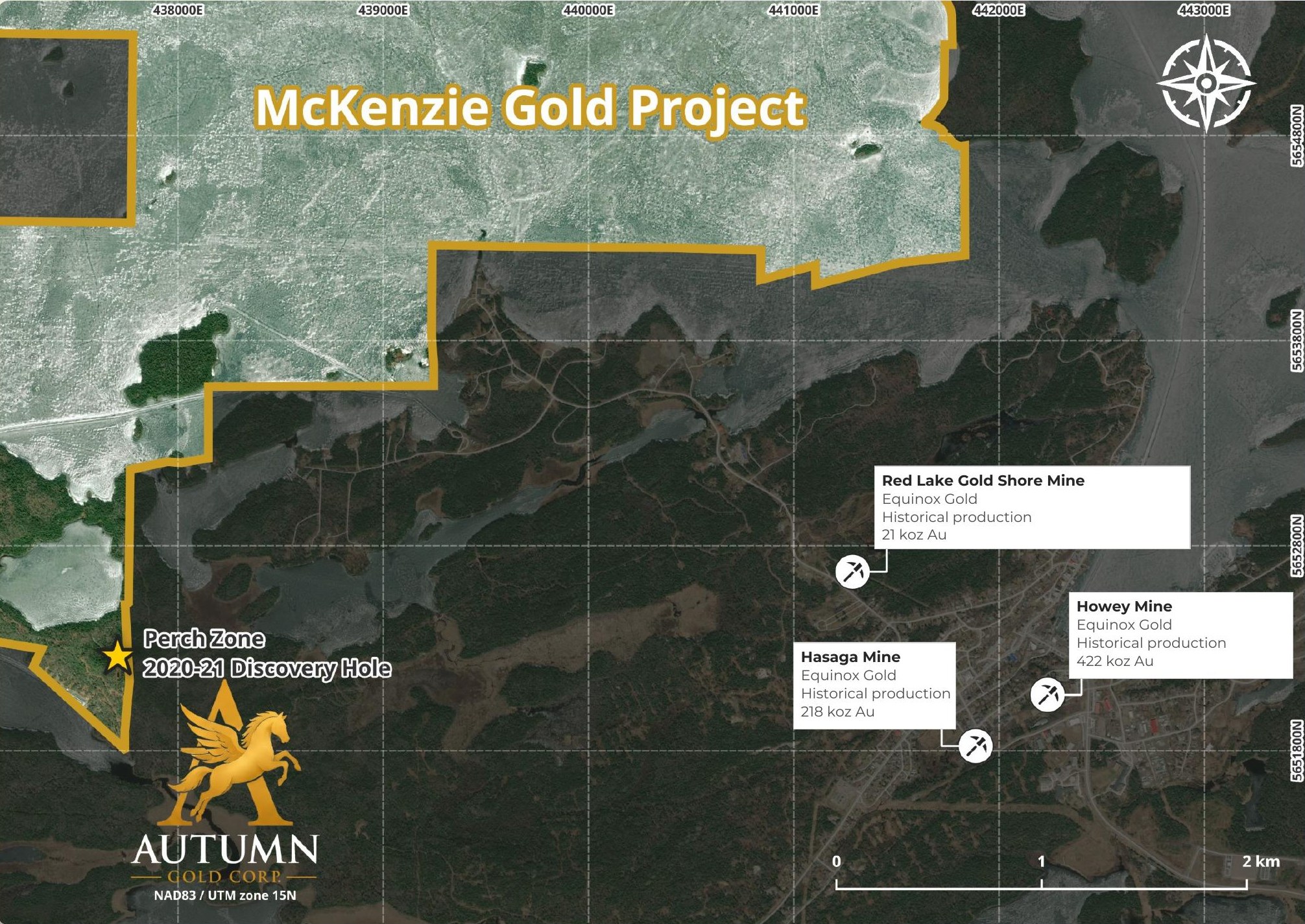
The Perch Zone discovery returned broad gold mineralization with narrower high-grade sections, similar in reported length and grade to selected early drill results at nearby Hasaga.
Size and scope of mineralization at Hasaga is not necessarily indicative of mineralization at McKenzie. Selected intercept comparisons do not establish comparable deposit size, continuity or economic potential.
Hasaga Property Mineral Resource Statement, effective 30 June 2024: indicated 1,470 kt @ 8.64 g/t Au for 408 koz; inferred 2,059 kt @ 7.31 g/t Au for 484 koz, at a 4.0 g/t Au cut-off. Reviewed and approved by Scott Heffernan, M.Sc., P.Geo., EVP Exploration, Equinox Gold. Not verified by Autumn Gold Corp. Comparison sources: Premier Gold drilling releases, April 5 and December 20, 2016; August 30, 2017. Reported intercepts are downhole lengths.